Surveying Ghana
since 1976.

One of the leading companies in Survey, Mapping, GIS, Environmental and Civil Engineering services in Ghana and the West African sub-region — with over 20 specialists and five decades of field experience.

Rudan Engineering — aerial survey operations
LiDAR Survey Operations

Five decades
of precision.

1976

Founded as a surveying firm in Accra, Ghana — the first private survey company of its kind.

1976

Founded as a surveying firm in Accra, Ghana — the first private survey company of its kind.

2000s

Expanded into digital mapping, GIS, and remote sensing, acquiring new photogrammetric capabilities.

2007–2011

Orthophoto mapping of 15,000+ sq km under the Ghana Land Administration Project — one of the largest aerial mapping campaigns in the country's history.

2007–2011

Orthophoto mapping of 15,000+ sq km under the Ghana Land Administration Project — one of the largest aerial mapping campaigns in the country's history.

2015 & 2016

Named Land Surveying Company of the Year at the Ghana Construction Awards — two consecutive years.

2020s

Full LiDAR capability deployed with Zenmuse L2 and YellowScan platforms. 8-drone UAV fleet operational across Ghana and the sub-region.

2020s

Full LiDAR capability deployed with Zenmuse L2 and YellowScan platforms. 8-drone UAV fleet operational across Ghana and the sub-region.

Today

Projects across 11 countries on 3 continents. Sub-regional leader in UAV/LiDAR survey and precision mapping.

Industry awards.

Ghana Construction Awards

Land Surveying Company of the Year

2015 & 2016

Memberships & certifications.

Member

Ghana Institution of Surveyors (GIS)

Member

Ghana Institution of Engineering (GIE)

Certified Operator

Commercial RPAS / Drones — Ghana Civil Aviation Authority (GCAA)

Five specialist
business units.

01

Land Survey

Cadastral, topographic, engineering, and setting-out surveys across all terrain types.

02

Mapping

LiDAR, drone, aerial, remote sensing, and digital mapping using the latest platforms.

03

Land Administration Services & GIS

Land titling, management, geographic information systems, and spatial data services.

04

Consultancy, Environmental & Engineering

Environmental Impact Assessments, civil engineering design, hydrologic studies, and geotechnical investigations.

05

General Administration

Finance, corporate governance, quality assurance, and health & safety management.

Survey-grade
equipment.

Rudan maintains an extensive fleet of modern survey and mapping instruments — from multi-sensor LiDAR drones to bathymetric echo sounders — enabling precise delivery in any environment.
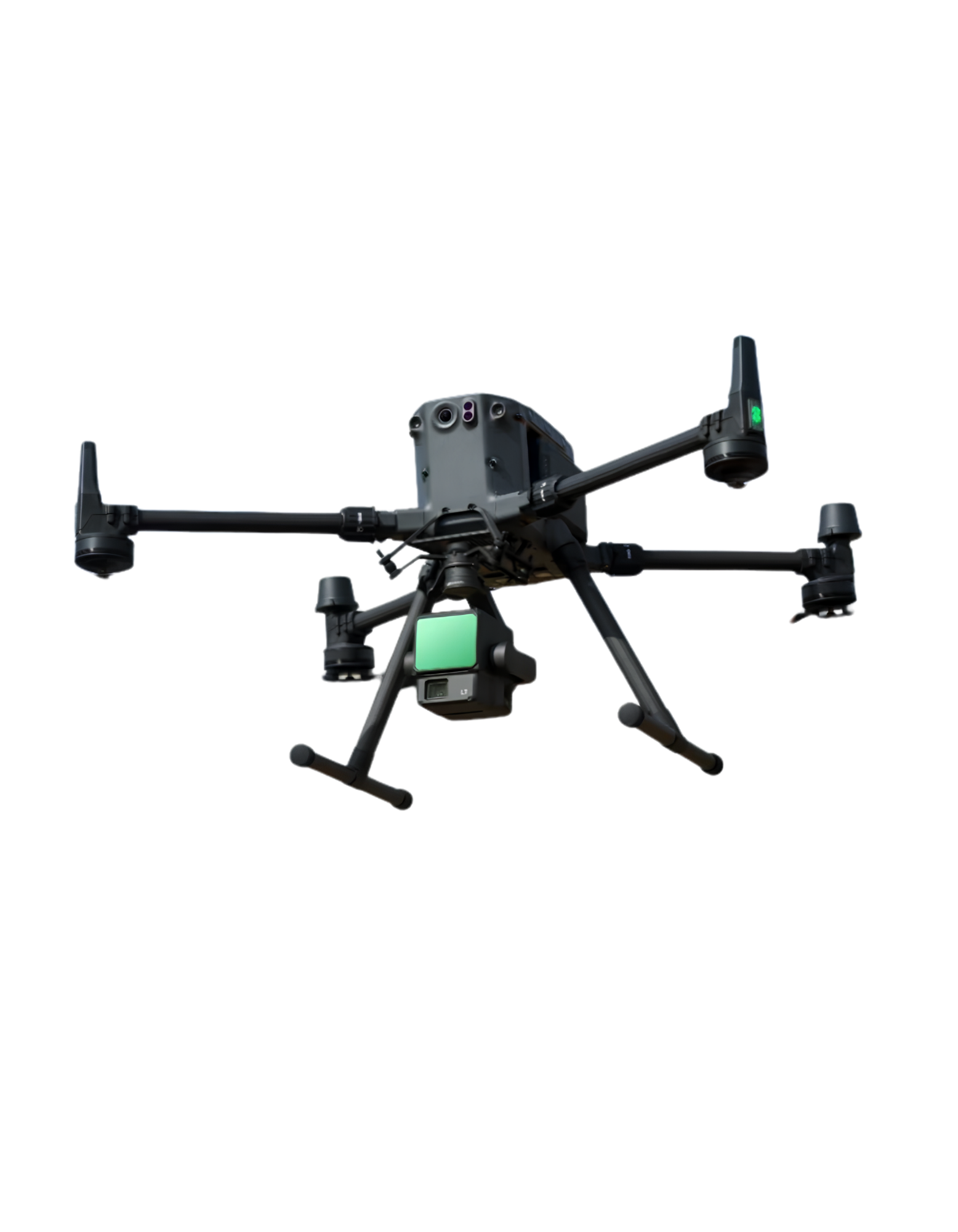
8UAVs & Drones
  • 8 UAV / Drones for Aerial Survey
  • 2 Zenmuse L2 LiDAR Units
  • 1 YellowScan Surveyor LiDAR Unit

Projects across
3 continents.

International Partners
01Kampsax (Denmark)
02COWI (Denmark)
03Finnmap International (Finland)
04PASCO Corporation (Japan)
05Fugro Inc.
06Géophoenix (France)
07Biwater International
08Penspen Ltd
09WSP Canada
10Photomap Ltd (Tanzania)
TogoBeninNigeriaCôte d'IvoireLiberiaBurkina FasoSenegalDR CongoTanzaniaIrelandUSACanadaGHANA HQ
Africa — 9 countries
International — 3 countries

Quality Assurance

Client-centred service focused on continuous quality improvement — meeting and exceeding expectations through effective teamwork and consistently improving processes. A philosophy practised without exception since 1976.

Health & Safety

Dedicated health and safety policy and instruction manuals govern all field operations. A strong environmental management philosophy guides every project, minimising site impact and safeguarding staff and communities.

Start your project with us.

Share your brief and we'll respond with a tailored approach shortly.